Free GPS Maps From Open Street Map

Free.  It is a word that we all love to hear.  This is especially true when it comes together with the words GPS maps.  It is also something that many of the current GPS manufacturers do not offer to their customers.  While many do allow recent purchasers to update the map on their GPS device to the latest version within 30 days of purchase, they then go and charge you anywhere between $50 and $100 for each subsequent map update.  If you are the type of person that likes to have the most current maps every year that can end up costing a lot of money.  Free GPS maps is certainly better than paid GPS maps.

Alternatively, some companies (like TomTom) have turned to crowdsourcing map updates so that users can help each other make the maps on their navigation devices better. TomTom’s service is called MapShare and allows users a high level of control over how they are able to update their maps using user generated content for free.  They boast to have the largest navigation community in the world, and they probably do since TomTom is a truly international community.

But the maps provided by TomTom and their MapShare service are not going to help every type of GPS enthusiast.  For starters, the update data can only be used by TomTom devices.  This leaves out those that use Garmin, Navigon, Lowrance, Magellan, and other GPS units from the wide range of GPS manufacturers.

The second problem is with manufacturer specific crowdsourcing efforts is that they only improve the maps for that specific manufacturer.  In my view, this has two major problems.  The first is that is it creates an inefficiency in the system.  The second is that the effort only benefits a select group of individuals.

So how can we create free GPS maps that all people can use irregardless of the particular GPS tracking device that they use?  Use Open Street Maps, that is how.

What is Open Street Maps?
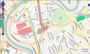
OpenStreetMap-RomeOpen Street Maps (OSM) is a really cool user driven world map.  It takes data taken from GPS tracking devices and turns it into information that is publicly available for any one to use for any reason.  It is much different from Google Maps in that the data is truly free – as in free speech – and is not bound by any limits or conditions – as in free beer.  This makes it somewhat superior to applications like Google Maps since it can be used in new and inventive ways without having to worry about lawsuits or other unpleasant occurrences.

Who benefits from Open Street Maps?

The short answer is everyone.

While it may not be the best GPS map in the world, OSM is at least among one of the best free GPS maps available.  It has data from all over the world and gives users access to everything about the map.  It also has a lot of things that many traditional navigation GPS maps simply don’t have.  Bike trails, hiking trails, shortcuts – these are all user entered, which can make them extremely useful for travelers who are trying to go to a new area where they may never have been.

Here is a list of people who might benefit extensively from OSM:

  • Cyclists – Knowing the streets where biking is acceptable is important for those moving to a new area, especially if you use your bike as your primary mode of transportation.
  • Hikers – Getting quality map data for a hike out in the wilderness can sometimes be pretty difficult.  If your destination is popular or you have friends that you like to exchange data with, doing so on a traditional GPS device can be problematic.  But with OSM you can do tap into the popularity of a locale or share mapping data with a friend very cost effectively – for free!
  • European travelers – OSM is much bigger in Europe than it currently is in the USA.  This means that instead of having to drop a nice chunk of change on some new European maps on your Garmin you can use OSM to get free Garmin GPS maps instead.

What can you do with Open Street Maps?

My one complaint with OSM is that it is not readily apparent how one can use the mapping information on your own GPS unit.  Most people are going to be looking for free downloadable GPS maps, and if OSM can’t provide that then they are going to look somewhere else.  Can someone use Open Street Maps to download free GPS maps?

Again, the short answer is yes – but it does get a little complicated.

Each specific GPS manufacturer has its own hoops and hurdles to jump through and over if you are going to want to use OSM data on these GPS devices.  If you are looking for a few guides on how to do so for the major GPS brands here they are:

In almost every case you are going to have to go to a third party that is going to allow you to use the OSM data on your GPS tracking unit.  To me, this is the biggest flaw of the whole OSM system – no clear method of using the data on your GPS.

To be honest, this is expected.  There are just too many different type of devices out there and too many companies trying to keep their piece of the pie their piece of the pie.  TomTom, for example, guards their mapping information so tightly that you have to do a serious work around just to use the OSM data on it.  Of all the companies listed above, Garmin is probably the easiest to use – but even with then you have to do some work to get the maps working right.

So while it is super cool that OSM is provided free GPS maps, they have a long way in actually making them useful for a large part of the GPS using public.

With this problem, should I still use Open Street Maps?

OpenStreetMap-mapping-teamYes!  Where are you going to get free, open source maps from if you don’t use OSM?  Well, there are lots of other places to get them, but nobody does it quiet like OSM.  You also have to realize that the more people who use something like this the better it gets for everyone involved.  Many hands make the work light, so it becomes very cool when you have thousands of people in your area working toward mapping out things for everyone for the common good.  Just imagine what it would be like if people who went to Yosemite got together and created awesome, free Yosemite GPS maps.  Any hiker who went there would benefit from everyone’s efforts for years and years after you death.  You could end up helping hundreds of thousands of people enjoy the outdoors because of your contribution to OSM.

When it comes down to it, when you want free GPS maps the best place to go is to the people.  Open source, crowdsourced solutions are going to provide accurate information that does the most good for society and for the individual.  When information is free, especially GPS tracking information, all people benefit.  While there are some things that Open Street Maps can do to improve the accessibility of the information, it is already an exceptional product.  I hope that it catches on quickly so that future generations of GPS users can benefit from it.
Different Types of Portable GPS Devices

Being able to find a portable GPS solution for your GPS tracking needs is going to be very easy. There are literally hundreds of units available to the person who is willing to keep their options open. You can find old GPS units that are not as powerful but are much, much cheaper or you can go with the top of the line in the GPS category of your choice and get the latest in functionality, but you are going to have to pay a premium for it.

Your search for a portable GPS might leave you a little bewildered when it comes to all the different choices available to you. Which unit should you buy? Will it meet your needs? Is there a better or a cheaper or a more useful GPS out there? Hopefully this article will provide information to help the person searching for the right GPS for them find it. Below is a list of a variety of different GPS devices that can be very portable and easy to use:

Navigation GPS

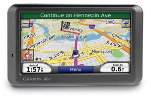
Garmin Nuvi 760 Portable GPS

Most people know about GPS because of the navigation models that have flooded the market. The earliest models were once hundreds of dollars, but now you can buy a navigation GPS for under $50. This type of device is going to be used mainly inside of a car, truck, or van and is going to be used to help a person get from point A to point B. Modern portable navigation GPS have a variety of different features including Bluetooth compatibility, real time traffic updates, weather announcements, text-to-speech turn-by-turn directions, and a few others. These add a little bit to the experience of users, but when it comes down to it these GPS devices are really just beautiful portable maps.

Marine GPS

Marine GPS, as you might have guessed, are meant to be used on the water. They provide fisherman, boaters, and other aquatic aficionados access to important location information that we once turned to the stars to establish. With a good chart plotter you can find your way back to your favorite ocean fishing spot, a really nice beach, or a hidden island somewhere off the coast. These devices are surprisingly affordable and if you already own a boat you are probably going to be rich enough to buy one of these portable GPS units.

The maps on these units is much like a navigation GPS except they might not have the same types of features as these navigational cousins have. What traffic is there on the open seas? What good is Bluetooth going to do you out on the ocean? That is why these devices generally ignore these features. But what you will get is a great GPS that is going to help you move about the water with confidence that you are heading toward your destination.

Geocaching GPS

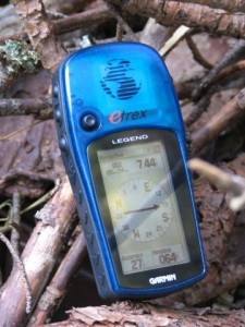
Garmin eTrex Geocaching Portable GPSGeocaching is a sport, or a hobby depending on who you talk to, that is very similar to a treasure hunt. How it works is that a person hides an object somewhere in the world. They then post the GPS coordinates of where they hid the item on a website like http://www.geocaching.com. Any person can then go on this website and jot down the coordinates of the treasure, or cache as it is called in the geocaching world. The person then goes to that cache using portable, hand-held GPS device like the Garmin eTrex H. Once they find it they take whatever treasure was hidden inside and then replace it with a treasure of their own.
Geocaching is great for kids, hikers, and people who need a little motivation to get outside and get moving. Most caches are going to require that you use your brains and muscles together, making this a great sport for people who like to be active but also enjoy a mental challenge as well.

Golf GPS

A golf GPS is a portable GPS device that is going to help golfers get a better understanding of where they are on a golf course at any given point in time.  They act as expert caddies that know the distance from any spot on the course to the hole, and with GPS helping out they are even more accurate than the best golfer around.  These devices can be pretty expensive, but a golf GPS is a must have for a golfer who has trouble choosing the right club for the shot or who is constantly traveling to new courses.  The Garmin Approach G5 is probably the best golf tracking GPS out there, but there are a few free applications available for the iPhone and Blackberry mobile phones.  All of these are extremely portable and extremely useful for the golfer.

Fitness GPS

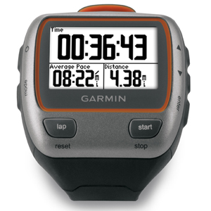
Garmin Forerunner 310 xt Portable Fitness GPSFitness GPS are meant to be portable by their very nature.  What good is a fitness GPS going to be if you can’t take it out with you and a run or on a bike ride?  Not very much.  As a result manufacturers make these devices small and highly mobile.  Some of the best fitness GPS equipment comes in the form of a wrist watch, the Garmin Forerunner series.  There are also GPS devices for cyclists, kayakers, and swimmers – giving them all a very technical look at their workouts.

These devices are really great because they help athletes improve their performance by being able to gather accurate and robust data on their workouts.  They can then use this data to improve their routines and concentrate on parts of them where they need the most work.

While not everyone is going to need to buy a fitness GPS watch, everyone would benefit from these powerful training aids.

Covert GPS Tracking

Another form of portable GPS devices are covert GPS tracking devices.  These units are designed to provide tracking information on a person or asset.  They are often installed covertly so that the person or assets doesn’t know about their presence.  These are often installed on cars to track them, but they can also be installed in boxes, bags, backpacks, or even clothes.  They can even be small enough to be comparable to a a USB memory stick!

The thing about covert GPS tracking device is that they are not going to be cheap, especially if you get one that has real time tracking capabilities.  If you just want a plain old vanilla data logger then you can find one for under $200.  If you want a real time tracker that has any type of battery life then you are going to have to drop a pretty hefty sum on it.  In addition to that you are going to need to pay for the tracking service and access to the GPS tracking software, which is probably going to run your anywhere from $15-$50 a month.

Car Tracking GPS

Car GPS tracking is a lot like covert tracking except that you don’t care if the person driving the car knows you are tracking them.  This is great for helping a teen driver drive safely or for recovering a stolen vehicle.  If you are going to be using the portable car tracking device to help your teen drive better than it is highly recommended that you discuss this with them and give them all the help and information they need to know to be a good driver.  No amount of GPS tracking is going to be able to make them a good driver unless they know some of the basic skills that make up a good driver.  For that they need a parent.

Theft recover GPS tracking is another use of car tracking GPS.  While these devices can easily be blocked using a GPS tracking blocker, these devices are still relatively useful in because they do have a very high recovery rate.  If your car gets stolen all you need to do is log on to your GPS tracking software service and you will be shown the exact location of your car in real time.  This makes it very easy for the police to use to find your vehicle and make an arrest.

Fleet Tracking GPS

Finally, the last category of portable GPS devices is the fleet tracking GPS.  These units are made specifically for businesses that need a better way to manage, dispatch, and protect their vehicle fleets.  Most consumers are not going to need this level of tracking so you probably won’t need to know too much about this type of tracking service.  What you do need to know is that these devices are extremely expensive but often have wonderful results for businesses that employ them.

I mean, just think about how useful it would be to be able to route, give directions, and monitor your vehicles with the assistance of portable GPS devices.  The ease of it would be ridiculous.  Generally speaking, small businesses have more success with the use of fleet tracking GPS than larger fleets – but almost universally there is an improvement when this technology is employed.

Which Portable GPS Do You Need?

As you can clearly see from the above analysis, there are three different types of portable GPS units. There is the unit that works like a mobile map. This GPS device is going to use the data it gathers from the Global Positioning System in conjunction with some mapping data already installed on the device. The coordinates that the GPS calculates via trilateration are placed somewhere on the mapping application and then displayed for the user to see. The navigation, marine, golf, and geocaching GPS all fall into this category.

They generally have rich displays that provide a lot of information to their users. Usability and intuitive interfaces are among the top priority for these devices, and that means they need to have a reliable connection to a GPS signal, bright, readable screens, and an easy way to navigate about the menus. Major names in these niches include Garmin, TomTom, Magellan, Lowrance, and Navigon.

The second category of portable GPS devices that we see in the list above is passive GPS tracking devices. This is the type of unit that does not have a digital map display but instead keeps a log of the GPS coordinates of where the device has been. This log is taken passively and is to be downloaded later for interaction with a secondary GPS software package. This software will interpret the information gathered by the tracking device and then spit it all back out in a way that is useful and makes sense to the user.

This type of device can be found in the fitness GPS and covert GPS tracking categories. Items like the Garmin Forerunner 405, Garmin Edge 705, and the TrackStick all fall inside this grouping. While both the Forerunner 405 and Edge 705 have a graphic display, this serves more of a fitness function than a GPS function. Things like speed and distance traveled are displayed rather than their position in the grander scheme of things. In order to get that type of information you have to download your workout history and run it through a GPS software to see where your workout took you.

The TrackStick has no graphic display whatsoever and is purely a passive tracking device. All you do with this GPS tracker is turn it on, place it where you want it to be, and let it do the tracking for you. When the battery runs out or when you no longer want to track that particular person or object you just remove the device and download the data. Your GPS tracking software will then interpret the data and put it on a map for you – but this map is going to be on your personal computer rather than on the portable GPS tracking device itself.

And finally, the last category of portable GPS devices are real time GPS tracking units. This set of devices differs from passive GPS trackers in that the information gathered by the device is communicated in real time to the GPS tracking software. You don’t have to wait to download the tracking log from the device as it sends out the data actively at set intervals.

These real time GPS tracking devices use a system know as GPRS (General Packet Radio Service) that is part of modern cell phone networks. It is the means by which this information is communicated to the GPS tracking software. If the GPS is unable to connect to a network where it can transmit the data you cannot get real time tracking with these devices.

As you can clearly see, the number of portable GPS units is astounding. Depending upon what GPS niche you are looking to get a device in will impact your level of choice significantly. There are some brand names that span many different categories, which the GPS giant Garmin being the dominate force in many categories, but there is no one clear leader in all fields of GPS devices. Be sure to read up and get informed about any particular device you are thinking about buying. While all of them are going to be using GPS to do what they do, not all portable GPS devices are equal.

Golf GPS Tracking

Knowing where you are at at any given moment on a golf course can be huge for your game.  Today, you can know the distance from ball to hole with a simple simple handheld device – a golf GPS tracking device.  This can be a stand along GPS, like the Garmin golf GPS Approach G5, or it could a mobile phone that has one of the golf GPS software upgrades installed on it.  Either way, you are going to get  some important improvement for your golf game by being able to make an appropriate club selection for your next stroke.

Handheld Golf GPS Units

There are several stand alone golf GPS units out on the market today.  These units are small enough to fit comfortably inside the pocket of your pants and can certainly fit inside your golf bag to be pulled out at a time convenient for you.  Here are several different GPS models designed specifically with golfers in mind:

Golf GPS Review: Garmin Approach G5

The Garmin Approach G5 is the cream of the crop in terms of personal golf GPS tracking units. The case is durable so it can jostled around a bit in your golf bag. It also is waterproof, so if you accidentally throw your golf clubs into the drink you won’t have to worry about destroying your investment (but we don’t recommend throwing anything into the water – its is just bad form). This GPS has a touch screen and comes preloaded with thousands of golf courses preloaded on the device. This device uses some of the latest GPS receiver technology to give golfers of all skill levels personalized and accurate distances to help users improve their club selection and their scores.

One of the great parts about the Approach G5 is that you get to look at the golf course you are on with a lot of detail. And since you can know your position on the course to within a couple of yards thanks to this Garmin’s high-powered GPS tracking receiver you can make full use of this detail. You don’t need to eye a hole and think that it is 100 yards away – you can get the full power of a constellation of 20+ global positioning satellites to give you your location in real time. This means that you can use the Approach at your buddies ball and then at your own in a matter of minutes without you both having to buy one of these devices.

The Approach G5 also will let you touch a spot on the course map so that you can get a picture of how far away your next shot is. If there is a bend in the hole that you want to get to but you don’t have the skills to bend your shot so that you can safely land in the fairway with every shot you simple touch the point you want your ball to land and pick the appropriate club for the task. You won’t have to guess anymore and your game will be more about being able to hit the ball well instead of about how well you judge distances.

If you are serious about keeping your game above board you don’t have to worry about breaking one of the USGA rules about golf GPS units – the Approach G5 meets all the golf GPS tracking rules that this organization has set.

One of the cool features that the Approach G5 has is that is can act as a digital score card for your foursome golf party. Keeping track of one of those pencils and score cards can be a real pain, especially if you are walking the course. You want every second of your time out on the greens to be about making the next shot, not about where you put that pencil.

Golf GPS Review: GolfLogix GPS

A little lower down the chain of quality golf GPS units is the GolfLogix GPS. This device is also made by Garmin, but doesn’t offer the awesome eye candy and functionality that the G5 does. It is still a very solid GPS for golf enthusiasts and comes at a significantly lower price than the G5.

This GPS will recognize the course that you are playing on automatically and will give you distances from the front, middle and back of the greens. It is light weight (5.3 oz) and incredibly durable. If you are thinking about getting a stand alone GPS tracking device for your golfing needs this is certainly going to be one that you have to at least consider.

It doesn’t provide the touch screen capabilities of the G5, but for users who just want to know distances to the green this unit will do just fine. It is one of the most well known golf course GPS units on the market today and comes with great support from the GolfLogix.

Golf GPS Tracking Applications For Mobile Phones

But if getting a dedicated golf GPS systems is not up your alley then you might want to consider turning your smart phone into one. We have already listed several different free GPS tracking software packages that let you turn your smart phone into a GPS tracking machine, but there is also a golf GPS program that can be downloaded for free as well.

If you have an iPhone or a Blackberry and want to us it as a golf GPS you should head over to the GolfLogix website. In addition to being the operators of the dedicated golf GPS unit mentioned above, they also offer free GPS applications for the iPhone and Blackberry mobile phones. This means that in addition to being able to install a regular GPS tracking software on your phone to let you know where you are or to let your loved ones know where you are you can also use it a golf GPS. In fact, you can even use your iPhone or Blackberry for both GPS functions at the same time!

If you are in the market for a golf GPS range finder but you don’t want to fork out hundreds of dollars and already have a smartphone then then you might want to consider getting one of these free applications. I don’t even think you need a good data plan for it because it doesn’t send data out of the phone like a normal GPS tracking application might. All you are doing is using your mobile phone’s computer to use the GPS information gathered from your phone to run against the mapping software produced by GolfLogix.

If you have any experience with any of the golf GPS tracking solutions let us know about it in the comments below.

Geomate Jr: A Kids GPS For An Active Child

Geocaching is a great way for kids to ditch their video games and TV for an active outdoor adventure.  Kids need some type of excuse to get outside and play in the great outdoors. A life of video games and TV has led to high levels of obesity in America when combined with a steady diet of processed food. Our children need to exercise if they are to break the cycle, so finding interesting and compelling reasons to get them out the door is something that parents are going to be looking for at every opportunity.

Geocaching combines our children’s love for technology with their need to get outside and DO something.  It is like a real life video game, kids must use an electronic device to find a hidden treasure located somewhere around them.  The device guides them to their location and helps them navigate the world around them.  The can run, or bike, or even walk on their search – all of theses activities are recommended by government orginizations as great ways to improve your child’s health.

But there is one catch with geocaching, the GPS devices traditionally used for it are anything but cheap.  Devices like the Garmin GPS 60CSx Handheld GPS Navigator and the Garmin eTrex Vista HCx Color High-Sensitivity Mapping Handheld GPS run somewhere above $200 a piece. Sure, they are great devices that can be used for way more than just geocaching, but do you really want to bed dropping that much money on a device that will help your kids play?

Savy to this issue, a company and product was create to solve this issue: Geomate.jr.  The product is significantly cheaper than the more traditional geocaching alternatives provide by Garmin and other GPS manufacturers.  Right now, you can get it for about $70 at REI. The only thing that even really comes close to this in terms of price is the Garmin eTrex H Handheld GPS Navigator, which is being sold four about $85.

The Garmin eTrex has received some pretty high praise from its users as a geocaching GPS.  Here is one that I though was particularly telling:

This is my primary Geocaching GPS. The high sensitivity chip has the same strong processing power, and thus signal sensitivity and position resolution, as any of the more expensive units. It gives me excellent accuracy in areas where my older GPS units just give up, even dense forest cover.

If you’re only interested in point to point navigation (geocaching, trail tracks or just finding your way back to the car or the ski chalet), then this unit will do a great job for a no-regrets price.

In my opinion, this is going to be the product that you are going to want to compare the Geomate.jr up against if you begin to seriously consider it as a geocaching tool for your child since the price difference is only about $15.

So, what are the Geomate.jr’s features?

  • Comes preloaded with about 250,000 geocache locations covering all 50 U.S. states
  • Turn the unit on and it will load up the closest geocaching location stored in memory; to find another location simply press the next button and the GPS device will automatically load the next closest cahce
  • Not only does the location of the nearest cache appear, but other important details also are displayed, such as the Geocaching.com ID code, the terrain, difficulty rating, and the size of the cache
  • Has a “Home” waypoint that will assist you in returning to your point of origin
  • Displays compass heading, latitude and longitude
  • You can keep a log of all the caches that you have visted so far so that you don’t do the same cache twice if you don’t want to
  • The ability to add more caches at a point in the future (at an additional cost)
  • Powered for 12 hours on AAA batteries

The features that seem the nicest about the Geomate.jr is that the loading of the geocaches is automatic.  You don’t need to input the coordinates into your device yourself since they already exist within the memory.  This seems idealy suited to kids who might not be familiar with how to input some information into a handhelf GPS navigation device like the Garmin eTrex H Handheld GPS Navigator.

But I also think that this feature is also the biggest drawback to this device.  Without the ability to add your own caches to the device you run the risk of the Geomate.jr running out of caches for your child to go and find.  Do you really want to fork out money for cache updates that you could do for free on the more traditional handheld GPS?  I don’t think I would as long as my child was wise enough to be able to input coordinates into the GPS device themselves.

It is also pretty important to note that none of these devices are going to let you be able to track your kids with GPS.  Instead, they are just there for enterainment purposes.

What do you think, is the Geomate.jr worth buying or would you rather go with the Garmin eTrex H Handheld GPS Navigator?